A Comprehensive Solution
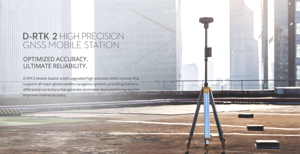
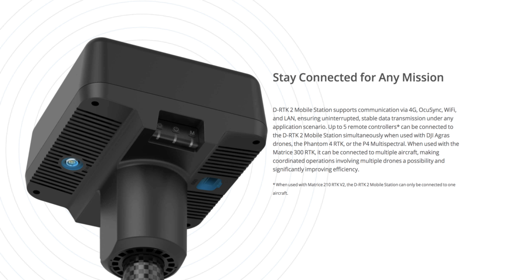
The D-RTK 2 Mobile Station is compatible with Phantom 4 RTK, P4 Multispectral, Agras Drones.
It also supports DPS (DJI Positioning Service), which provides high precision positioning data within the cover range of the base station, making it the ideal tool for surveying, aerial inspections, agriculture, and other industrial applications.

Centimeter-Level Positioning
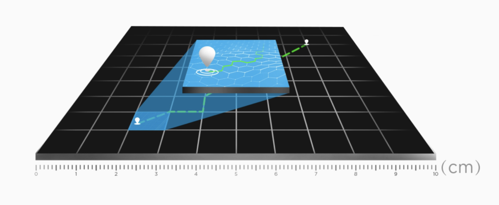
D-RTK 2 Mobile Station fully supports GPS, GLONASS, Beidou, and GALILEO signals. Easy and quick to set up, the D-RTK 2 Mobile Station provides real-time differential data for drones to achieve centimeter-level positioning accuracy. The built-in high-gain antenna offers better signal reception from more satellites even when obstructions are present.


RTK (Real-Time Kinematic) and D-RTK2 (Differential Real-Time Kinematic 2) are both technologies used in global navigation satellite systems (GNSS) to provide highly accurate positioning information. Here’s a brief overview of each:
RTK (Real-Time Kinematic):
- RTK is a technique used to enhance the precision of satellite positioning systems. It is commonly used in applications where high accuracy is crucial, such as in surveying, agriculture, construction, and unmanned aerial vehicles (UAVs).
- RTK works by using a fixed base station with a known location to send correction data to a rover or mobile device in real-time. This correction data helps the rover to correct its position, resulting in centimeter-level accuracy.
- RTK typically relies on a single base station, and the corrections are transmitted to the rover through a communication link, such as radio or cellular networks.
D-RTK2 (Differential Real-Time Kinematic 2):
- D-RTK2 is an advanced version of RTK developed by DJI, a Chinese technology company known for its drones and other aerial systems. D-RTK2 is designed to provide high-precision positioning for DJI products.
- D-RTK2 incorporates dual-frequency GNSS receivers, allowing it to receive signals from both GPS and GLONASS satellites. This dual-frequency capability enhances the accuracy and reliability of the positioning data.
- D-RTK2 also includes additional features such as support for multiple satellite constellations (GPS, GLONASS, BeiDou, and Galileo), advanced algorithms for improved performance in challenging environments, and a modular design that allows it to be used with different DJI products.
In summary, while both RTK and D-RTK2 are based on the RTK technique for achieving high-precision positioning, D-RTK2 is a specific product developed by DJI that includes additional features and improvements tailored for compatibility with DJI’s products, particularly in the field of aerial systems and drones.
麦吉尔大学(McGill University),简称McGill,坐落加拿大第二大城市蒙特利尔,是一所蜚声全球的世界顶尖名校。学校始建于1821年,是加拿大历史最悠久的高等学府。麦吉尔大学在医学、法学、工学、理学、商学、文学、神学、音乐等众多领域拥有崇高的学术地位及广泛的影响力,被公认为是当今世上最享负盛名的学府之一,百年来一直在国际上极富盛誉,鼎盛时期与哈佛大学双足鼎力,其教学及研究水准享誉世界,故有“加拿大哈佛”之称。
是加拿大排名第一的医学博士类大学。麦吉尔大学以极高的学生质量和严谨的学风着称,作为加拿大最难申请的大学,其录取分数线、奖学金门槛和课程难度为全国高校之最。
乔治亚学院 是位于安大略省旅游中心地带的公立社区学院,有着三十多年的历史。她拥有贝瑞(Barrie),奥里利亚(Orillia)和欧文桑德(Owen Sound),Midland,Muskoka,Orangeville,South Georgian Bay等三个校园,而且这三个校园都位于多伦多附近。尤其是位于贝瑞市的主校园,距离多伦多仅90公里,交通便利,环境优美。贝瑞邻近多个著名的旅游景点,如尼亚加拉大瀑布等,她附近还有多个自然保护区、公园和庞大的湖泊,其露营和康乐设施深受欢迎。贝瑞的天气也如多伦多一般四季分明:和暖的夏日最适宜游泳、打网球、高尔夫球和划艇,而冬季的活动则有滑雪、溜冰和冰上曲棍球等。
滑铁卢大学是一所以研究为主的中等大小的公立大学,创建于1957年。该校位于安大略省的西南面的滑铁卢市,以学习与实习并重的合作教育(co-operative education)而闻名。2011年到2013年,该校一直稳居麦克林杂志评选的加拿大综合性大学排名的第三位,是北美地区最优大学之一,其数学,计算机科学和工程学科教学水平居世界前列。
滑铁卢大学教学设施完善,科研设备先进,学术力量雄厚,是一所著名的综合性公立大学。下设文学院、理学院、工程学院、数学院、环境学院、应用健康科学学院。滑铁卢大学设有北美唯一一所数学院,这也是全世界最大的数学和计算机的教育及研究中心。同时,在北美洲,该校是最早采用计算机教学的学府,而这所大学的计算机学科在整个北美洲也是极有名气的,加拿大其他大学在计算机科学领域上难以望其项背。除此之外,滑铁卢大学工程院拥有加拿大最好的软件工程,电子工程及机械工程专业。
百年理工学院成立于1966年,是安大略省第一所政府公立学院,拥有多种享誉加拿大名列前茅的专业和设施,课程设置注重理论与实践相结合,以高标准的教学质量为基础,以适应社会需求为目的,每门课程优师优质,确保学生学有所长、学以致用。
百年理工共设置有8所分院,位于4个校区,提供超过160种国际认可的证书、大专文凭、大学学士学位及研究生证书等课程,专业范围涵盖商业、旅游与文化、工程技术与应用科学、健康与社区研究、交通、传媒与设计,以及英语语言等,由超过1,500名的专业教职人员为18,000余名全日制学生和20,000余名成人教育学生传授知识和技能。学校与5个战略合作伙伴以及600个商业和民间组织保持密切联系,并与近40所世界著名院校进行广泛合作。
渥太华大学 (University of Ottawa, 或uOttawa) 始建于1848年. 是加拿大最古老和全球最大的英法双语大学, 其前身是由无玷圣母献主会(Missionary Oblates of Mary Immaculate) 在1848年创办的Bytown学院, 1866年获得由维多利亚女王颁发的Royal Charter (加拿大仅有9所大学拥有 ); 1889年获得教皇Pope Leo XIII颁发的 Pontifical Charter。创立伊始,渥太华大学就显示出她的强大实力。时至今日,已一跃成为声名大噪的学术研究中心。全校教职工2,887人, 行政职工2,425人。在校学生总学生数达40,712人 , 其中国际学生占4%。
温莎大学是历年来加拿大最好的十所综合类大学之一,位于温莎市的大学城。温莎大学有着友好的校园环境,浓厚的学术气氛,同时兼有所有大城市的便利。温莎大学学科齐全,包括商业、教育、工程、人类科学与体育、法律和社会学等领域,提供本科、研究生和博士学位,实习及专业学士学位。 大学校园设备先进,设施齐全,除了功能齐全的STDENIS体育馆,还有全加拿大最好的现代医疗保健中心CAW学生中心和藏书超过两百万册的LEDDY图书馆。学校和美国的多所著名大学有着共享图书馆的协议,学生可到美国大学图书馆阅读、借阅。整个校园都被先进的光纤电脑网络连接,及时了解全球发展。 温莎市被誉为“加拿大的汽车工业首都” ,同时也是加拿大最大三家汽车制造企业及上百家高科技公司的所在地。凭借地理优势,温莎大学与工业界先后合作设立CHRYSLER加拿大汽车工业研究与发展中心,世界级伦敦生命五大湖区环境研究中心和其它学术中心。
西安大略大学坐落在加拿大风景秀美的著名城市伦敦。伦敦市是加拿大第十大城市,人口49万 ,距加拿大第一大城市多伦多200公里。始建于1878年的西安大略大学是加拿大最古老的学校之一,她在学术方面已经有上百年历史,并在商科、医学和文科方面取得了辉煌的成就,学校继续保持高速发展并不断扩展在学术方面的研究。尤其是近些年来,西安大略大学实施了一系列旨在扩展传统优势学科的举措,以期实现专业的多元化,例如开设了健康科学、软件工程等等。在校学生约为为36,000人,其中有来自120多个国家的留学生约2,200名,国际生占比为4.50%,全日制教职员工3,200人,提供2,000多个学士学位与文凭课程 。西安大略大学与女王大学,多伦多大学,麦吉尔大学组成的橄榄球联赛称为加拿大老四校(the Old Four) 。
加拿大约克大学(York University)位于加拿大第一大城市多伦多北郊,是全加拿大综合规模第三大的大学。大学建立于1959 年,当时的约克大学被视作多伦多大学的分校只有76名学生,如今校园宽阔,共占地635 公顷,面积之大可以用“一望无际”来形容。学校设施全面,设有10个学院,24个研究中心,其学生数量超过5万人,教职员工也接近5000 人。
一直以来约克大学以工商管理、法律、文科、计算机科学、社会科学等专业而闻名。其工商管理专业在伦敦《金融时报》排名中名列全加拿大第1名。在加拿大《麦克林》杂志2015年的大学排行榜上,约克大学位居综合类大学第8名
女王大学又名皇后大学 是安大略省第二古老的大学,1841年根据维多利亚女王的皇家宪章建立,原为教会赞助学校,1912年变为非教会学校。在学术方面,女王大学一直保持着很高的水准,共开设包括商科、医学、法学、生物、工程、文科及理科等15个不同的院系,并设立Bader英国学习中心,华盛顿学习中心等。
女王大学现已开设的课程包括:应用科学、文理、商科、教育、研究院、法律、护理、体育、康复治疗、神学、艺术等,同时,学校不断增加其他具有领导性的专业。校友文化是女王大学核心文化的重要组成要素之一,学校每年凭借校友的资助,建设许多新型设施装备。从实验室到体育馆,从图书馆到学生活动中心。校内0.45亿美元的Joseph S. Stauffer图书馆为学生提供便捷的电子服务;在考试期间,Stauffer图书馆一周24小时全天开放。
多伦多大学(University of Toronto) 是加拿大一所著名的公立大学,始建于1827年,是加拿大最古老的大学之一。学校坐落于世界上最适合人类居住的城市——多伦多,拥有3个校区,300类大学本科专业,32座图书馆。多伦多大学科研水平高,规模大,师资力量强,教学质量高,具备最新的教学方法和先进的教材,拥有世界级教学设备,被公认为是加拿大综合实力数一数二的优秀大学。凭借其规模、声望以及影响力,多伦多大学正吸引着加拿大国内及世界各地的顶尖学生。
文理学院是多大最大的学术单位,它拥有语言学系、英语系、意大利语系、斯拉夫语言文学系、社会科学系、历史学系、哲学系、经济系、人类学系、天文学系、植物学系、化学系、计算机科学系、美术系、东亚地区研究系、地理系、地质系、中东地区及伊斯兰研究系、物理学系、化学系、心理学系、数学系、统计系等30余学术院系,800多个教学项目。文理学院还辖有因尼斯学院、新学院、圣迈克尔学院、三一学院、大学学院、维多利亚学院、韦氏和学院等9所半独立学院共50多个教学项目。
不列颠哥伦比亚大学(英语:University of British Columbia,法语:Université de la Colombie-Britannique,简称UBC),简称卑诗大学,是一所位于加拿大卑斯省的公立大学,也是U15大学联盟、英联邦大学协会、环太平洋大学联盟、和Universitas 21成员之一。UBC为全世界培养了众多的顶尖人才,学术声誉极高,至目前为止共有7位校友获得诺贝尔奖,其中包括著名经济学家罗伯特·蒙代尔。UBC于1908年创校,现在总共有两个主要校区。学校主校区位于紧邻温哥华市西端的大学保留地,为卑斯省最古老的大学,起初为研究性合作机构,后来逐渐发展为闻名国际的综合大学;另外该校位于基隆拿市的新校区成立于2005年,称为不列颠哥伦比亚大学奥卡纳干分校,取代原奥卡纳干大学学院。